William Dargue A History of BIRMINGHAM Places & Placenames from A to Y
Bournbrook
B29 - Grid reference SP052827
Burnebrock: first record c1250

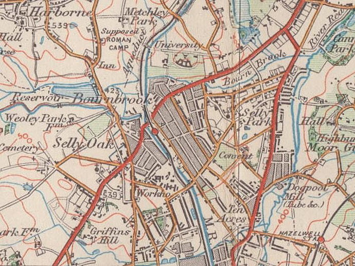
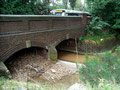
The stream which flows from west-to-east north of Bournville is called the Bournbrook. It runs immediately south of Birmingham University, is bridged by the Bristol Road at Bournbrook Road and joins the River Rea at the north end of Cannon Hill Park.
Confusingly, the stream that actually runs through Bournville itself is called the Bourn. Before the creation of the name Bournville, the future location of the Cadbury chocolate factory was described as Bournbrook or Barnbrook. However, the name now refers to the area around Bournbrook Road.
The earliest recorded form of the name is Burnebrock, which appears to derive from Old English burna broc. The word burn was used, as it is still in the North of England and in
Scotland, to mean 'clear running water'. The word 'brook' tended to be used for muddy rivers through marshy or boggy land or running over clay. This makes the translation of burna
broc problematical: a 'clear muddy stream'? However, an interpretation is also possible based on the fact that bourn is an earlier word which means a brook which served as a
boundary. Here the stream marked the boundary between the manor of Harborne in Staffordshire and the Worcestershire manor of Northfield. It has also been suggested that the first element of
the placename may derive from an attested Anglo-Saxon personal name, Beorna.
See also Bournville and Selly Oak.
Click to enlarge the images in the Bournbrook Gallery below.

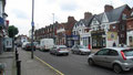
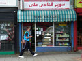
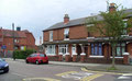


If there is still a modern district called Bournbrook, it is centred on the shops along the Bristol Road between Birmingham University and the Cross-City railway line.
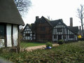
The residential district lies around the original site of a timber-framed building now re-erected on Bournville Green and (incorrectly) known as Selly Manor. The house (confusingly and incorrectly sometimes known as Bournbrook Hall) stood on Bournbrook Road near the junction with Coronation Road. This 14th-century yeoman farmer’s house was dilapidated by 1426 when it was rebuilt by Thomas Jouette, the lord of the manor. The house was again restored and extended in the late 15th century.
By 1906 the building, by then known as Rookery Cottage/s or The Rookeries, was derelict once more and in danger of being lost until its value was recognised by George Cadbury. He had it
carefully and systematically dismantled to be re-erected in 1916 close to Bournville Green using as much original material as possible. Now called Selly Manor, it is a public museum owned by the
Bournville Village Trust, a Grade II Listed building that is well worth a visit.
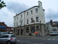
A new house, also known as Bournbrook Hall, was built almost on the site of the old house as the vicarage of St Wulstan's church; it is now a care home called Bournbrook Manor.
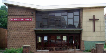
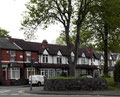
The district was built up during the 1880s. St Wulstan's Church was opened in 1893 on the corner of Exeter Road as an iron mission of St Mary's, Selly Oak.
By 1900 six services were held every Sunday. The foundation stone of the new church building was laid on St Wulstan's Day 19 January 1906 and the red- and blue-brick building in decorated gothic-style was consecrated 1906 with accommodation for over 700 worshippers.
By the late 1970s the congregation had declined and in 1980 the parish merged with that of St Stephen's, Selly Hill. In 1983 the church agreed to exchange premises with that of the expanding Elim Pentecostal Church in Alton Road.
William Dargue 18.09.2008/ 24.10.2015
For 19th-century Ordnance Survey maps of Birmingham go to British History Online.
Map below reproduced from Andrew Rowbottom’s website of Old Ordnance Survey maps Popular Edition, Birmingham 1921. See Acknowledgements. Click the map to link to that website.