William Dargue A History of BIRMINGHAM Places & Placenames from A to Y
Bromwich Wood
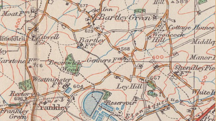
B32 - Grid reference SO998810
Bromwiche: first record 1275
This 3-hectare site of Ancient Semi-Natural Woodland lies at the west end of Bartley Reservoir along Scotland Lane. 'Ancient' is defined as pre-dating the year 1600; 'semi-natural' signifies that, though it has probably been managed economically eg. pollarded or coppiced, it has been left to regenerate naturally without human intervention. The woodland here, which is recorded in parliamentary papers of 1602 as consisting of oak and alder, was probably hundreds of years old at that time. First recorded as Bromwiche in 1275, the name is found as Bromwychestude in 1350 and as Bromwycheslond in 1410.
This site lies within the Green Belt on the rural boundary with Worcestershire, It was designated a Local Nature Reserve in 1991 and is also a Site of Importance for Nature Conservation. The south-west edge of the wood is marked by a dry ditch and earth bank of unknown date. The bank may well have been topped by an impenetrable hedge of hawthorn designed to keep animals out of the woodland.
The name derives from the Old English brom wic meaning 'broom farm'. A wic was usually a subsidiary (dairy) farm belonging to a settlement elsewhere, though where the original
farm itself stood is unknown. Bromwich Wood may have belonged to that farm or at any rate have stood near it. Broom is a shrub typical of lighter well-draining soils. However, the predominant
tree cover now is pedunculate oak with wild cherry, the former more typical of heavier clay soils.
William Dargue 12.10.2008
For 19th-century Ordnance Survey maps of Birmingham go to British History Online.
Map below reproduced from Andrew Rowbottom’s website of Old Ordnance Survey maps Popular Edition, Birmingham 1921. Click the map to link to that website.