William Dargue A History of BIRMINGHAM Places & Placenames from A to Y
Kitts Green
B33 - Grid reference SP152872
Kitte Green: first record 1495
The addition of the family name implies that the Kitts had taken probably ownership of what had previously been common grazing land. The location is shown on the 1834 Ordnance Survey map at the junction of Lea Village (the road name) and what is now Kitts Green Road. The green was located between Yockleton Road and Lea Village.
Kitts Green municipal housing estate was built before World War 2 as part of one of the City Council's largest developments. It was designed to house over 15,000 residents in an area north of the
Meadway between Stechford and Tile Cross.
The modern district known as Kitts Green is west of the original location and derives its name from Kitts Green Road, the main road running through the estate from Glebe Farm through Lea Village. What was originally called Kitts Green is now known as Lea Village.
Photographs below by Christine Johnson on Geograph SP1587 reusable under Creative Commons licence Attribution-ShareAlike 2.0 Generic (CC BY-SA 2.0). Left: Moodyscroft Road north of the junction with Heynesfield Road. Right: Houses on the west side of Kitts Green Road. Centre: image from Google Maps Streetview of Yockleton Road.


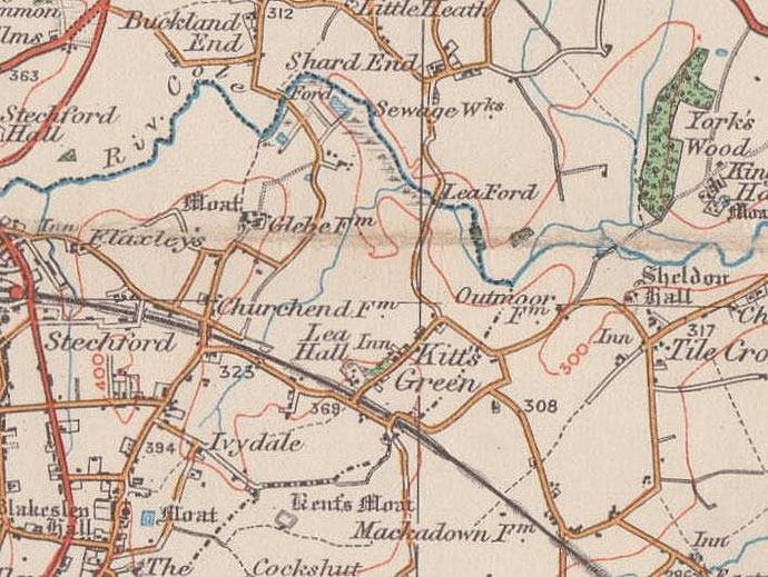
Below: maps showing how Kitts Green has 'moved'. Click to enlarge.

James Booth aluminium factory was built on Kitts Green Road in 1938. Parts were made here for building Spitfire fighter planes (See Castle Vale). The plant has passed through a number of hands since then supplying high-strength aluminium plate to aircraft builders throughout the world including Airbus and Boeing. The factory, the UK's largest aluminium rolling mill, is now run by Arconic producing military armour, engineering, tooling and aerospace plate.
Images of Arconic below from Google Maps.


William Dargue 29.03.2009/ 07.10.2012/ 02.01.2021
For 19th-century Ordnance Survey maps of Birmingham go to British History Online.
Map below reproduced from Andrew Rowbottom’s website of Old Ordnance Survey maps Popular Edition, Birmingham 1921. Click the map to link to that website.