William Dargue A History of BIRMINGHAM Places & Placenames from A to Y
Kitwell
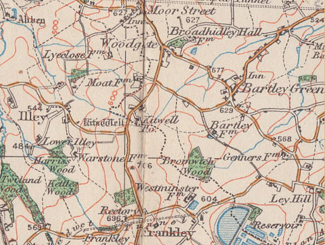
B32 - Grid reference SO992814
This late 20th-century housing development lies north of Bartley Reservoir around Kitwell Lane. Formerly part of Bromsgrove District the area became part of Birmingham in boundary reorganisation in 1995.
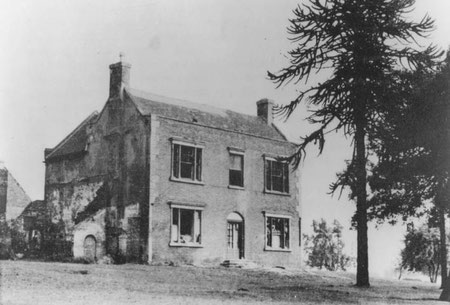
The estate is named after a large mansion, Kitwell House, which stood off Kitwell Lane south of Bucknall Close. This in turn took its name from a chalybeate spring, Kitt's Well, which was located
south of the house on the west side of Kitwell Lane.
Such springs were often considered as sacred from the earliest times and taken over as holy wells after the advent of Christianity. They may have been used for baptisms.
The word chalybeate derives from the Latin word for steel and is used to describe springs with a high mineral content, often rich in iron. During the 18th century taking the waters by bathing or drinking was a fashionable pursuit for the wealthy.
One Peter Kytte was living in Northfield in 1275. Kittelond, Kitte's land, is also mentioned in a deed of 1362 relating to Warley-Wigorn. Kitt was often a short form of Christopher.
Kitwell House was the birthplace of Jane Webb in 1807. Orphaned at 17 she helped make ends meet by publishing three years later 'The Mummy!' under a male pseudonym. The novel tells of a vengeful pharaoh who is brought back to life in 22nd-century London. The idea has been taken up by many subsequent authors and film makers.
However, the novel was a one-off. After marrying the landscape gardener, John Claudius Loudon whom she met while he was laying out the Botanical Gardens in Edgbaston, she turned to writing gardening books for lay people for which she was well-known at the time. In 2008 Jane Loudon was commmemorated by a Birmingham Civic Society blue plaque placed on the wall of Kitwell School in Wychbury Road which stands near the site of Kitwell House.
William Dargue 08.02.2009
For 19th-century Ordnance Survey maps of Birmingham go to British History Online.
Map below reproduced from Andrew Rowbottom’s website of Old Ordnance Survey maps Popular Edition, Birmingham 1921. Click the map to link to that website.