

William Dargue A History of BIRMINGHAM Places & Placenames from A to Y
Kingswood/ Kings Wood
B47 - Grid reference SP066780
Kingswood: first record 1650

Originally part of the royal manor of Kings Norton, this wood covered an area between Hollywood and Walkers Heath. The 1834 Ordnance Survey map shows a hamlet of this name at the junction of Crab Mill Lane with Bells Lane.
William Hutton in his 1783 History of Birmingham relates a tale about the enclosure of Kingswood by Roger de Mortimer, Earl of March. The Mortimers had built up extensive possessions in the Kings Norton area and were finally granted the manors of Bromsgrove and Norton by Edward II in 1317.
Roger de Mortimer was a ambitious and ruthless man who, it is believed, forced Edward to abdicate and later had him murdered, making himself Edward III's Regent. About the same time, during the 1320s, Mortimer had a great bank dug to enclose what had previously been common land shared by the parishes of Kings Norton, Solihull and Yardley. William Hutton tells the tale:
Upon King's-wood, five miles from Birmingham, and two hundred yards east of the Alcester-road, runs a bank for near a mile in length, unless obliterated by the new inclosure; for I saw it complete in 1775. This was raised by the famous Roger Mortimer, Earl of March, about 1324, to inclose a wood, from whence the place derives its name.
Then that feeble monarch, Edward the Second, governed the kingdom; the amorous Isabella, his wife, governed the king, and the gallant Mortimer governed the queen.
The parishes of King's-norton, Solihull, Yardley, uniting in this wood, and enjoying a right of commons, the inhabitants conceived themselves injured by the inclosure, assembled in a body, threw down the fence, and murdered the Earl's bailiff.
Mortimer, in revenge, procured a special writ from the Court of Common Pleas, and caused the matter to be tried at Bromsgrove, where the affrighted inhabitants, over-awed with power, durst not appear in their own vindication. The Earl, therefore, recovered a verdict, and the enormous sum of 300l. [£300] damage. A sum nearly equal, at that time, to the fee-simple of the three parishes.
The confusion of the times, and the poverty of the people, protracted payment, till the unhappy Mortimer, overpowered by his enemies, was seized as a criminal in Nottingham-castle; and, without being heard, executed at Tyburn, in 1328.
The distressed inhabitants of our three parishes humbly petitioned the crown, for a reduction of the fine; when Edward the Third was pleased to remit about 260l [I = £].
William Hutton 1783 An History of Birmingham
After Mortimer's execution, those found guilty petitioned the new king, Edward III who reduced the fine by £260. The case was heard by the King at Waltham 26 January 1331 and the setting up of an inquiry is recorded in the Patent Rolls which are now held in the Public Record Office.
Commission to Adam de Herwynton, William de Shareshulle and Ralph de Perham to inquire and certify the king touching a petition of those having common of pasture in Kyngesnorton Wode, co. Worcester setting forth that Roger de Mortuo Mari [Mortimer], late earl of March, caused part of their common land to be enclosed with a dyke, which they being thereby deprived of their inheritance filled up again as was lawful ; that the earl obtained a plea of trespass against them whereon they were convicted by jurors dwelling far from the said land who had been put upon the panel by Richard de Haukeslawe, the earl's steward, then sheriff of the county, they themselves and their attorneys not daring to appear at the inquisition for fear of assault and even death, and cast in damages of 300/. [£300] ; and praying pardon of this sum which has escheated to the king.
Translated from Latin
Calendar of the Patent Rolls Preserved in the Public Record Office - Edward III 1330-1334 HMSO 1893
It is thought that the commissioners held court at Warstock, the meeting point of the the parishes of Kings Norton, Solihull and Yardley. The importance of common land in the Middle Ages to farming people is well demonstrated here even in the face of a so powerful an adversary as Mortimer.
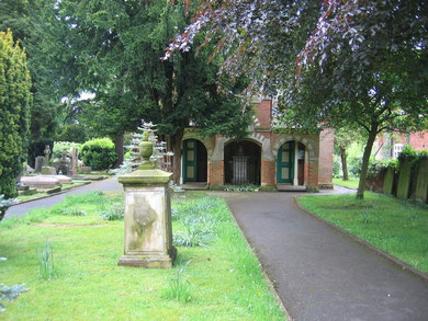
Kingswood Unitarian meeting house was built in 1708 on Dark Lane, Hollywood by a group from Birmingham. During the 'Church and King' Riots of 1791 which were sparked off by a dinner in celebration of the French Revolution, rioters created a trail of destruction in and around Birmingham. Linking non-conformity with republicanism, they had already burned the two meeting houses in town and the houses of a number of wealthy people they thought may be dissenters.
A gang of rioters travelled out as far as out as Kingswood where they burned down the chapel as well as six houses in Kings Norton. The meeting house was rebuilt in nearby Packhorse Lane by 1793 by members of the congregation.See 1791 Birmingham Riots.
Kingswood remains an area of farms and fields, though with very little woodland, beyond the city boundary.
William Dargue 29.03.2009/ 01.08.2010
For 19th-century Ordnance Survey maps of Birmingham go to British History Online.
Map below reproduced from Andrew Rowbottom’s website of Old Ordnance Survey maps Popular Edition, Birmingham 1921. Click the map to link to that website.
