Sutton Park, Sutton Chase, Sutton Heath, Sutton Walk
The Coldfield, Coldfield Heath
B73/B74 - Grid reference SP095967
First record: Sutton- in-Coldfield 1242; free Chase of Sutton 1307; Sutton Park 1459

Sutton Chase (and Park) is inextricably linked with the history of Sutton Coldfield. It was formed from part of Cannock Forest or Chase, a royal hunting ground from the times of the Anglian kings of Mercia between the Rivers Trent and Tame.
The property of the English Crown since the Norman Conquest, part of Cannock Chase was given by Henry I in 1126 to the Earls of Warwick. This part was Sutton Chase whose boundary followed the River Tame from Salford via Perry Barr to Barr Beacon, then from the source of Bourne Brook/ Black Brook, north of the Beacon to its confluence with the Tame at Fazeley near Tamworth, then back along the Tame to Salford Bridge.
Sutton Chase lay largely within the manor of Sutton in Warwickshire but included the south-eastern corner of Staffordshire, extending into the manors of Drayton Bassett, Weeford and Hints. In Warwickshire the Chase intruded into the manors of Berwood and Middleton.

The earls of Warwick held the rights to hunt anywhere within the chase and also to empark ie. to create enclosed deer parks. And in 1289 Earl William was also granted the right to continue hot pursuit of deer into the king's forest of Cannock. Evidence of the boundary of the medieval deer park can be seen along the Chester Road North, Thornhill Road and Streetly Lane where 12th-century banks and ditches survive. A fence or thorny hedge on top of the bank would have prevented deer from escaping as well as discouraging intruders.
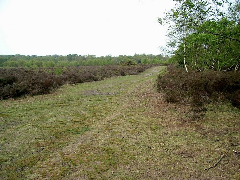
While the centre of the town lies in the river valley of Plantsbrook, the Chase lies on the higher ground on the Sutton plateau, which covers an area between Aldridge and Hamstead to the west and
from Bassetts Pole to Tyburn in the east. Underlying sandstone and pebbly sandstone conglomerates give the Chase its heathland character.
Part of the Chase was later known as The Coldfield. This is shown on the 1834 Ordnance survey maps as an area south of the Sutton Park and outside it. The extent was wider than
this however, and probably reached as far as Great Barr. The word col in Anglo-Saxon referred to 'charcoal'. Charcoal production involves 'baking' wood slowly in the controlled absence
of air. Sticks up to a metre long were left to dry before being placed in a pit up to 5 metres in diameter. The wood was lit and buried under soil with enough air holes to keep it slowly
smouldering for several days before being gently cooled with water. The resulting charcoal is a slow burning fuel which reaches high temperatures and has been used for thousands of years in glass
making, pottery kilns and metal smelting, the latter industry becoming increasingly vital from the 16th century to Birmingham's industrialisation. The wood is often sourced from coppiced or
pollarded trees. Charcoal production continued into the 18th century when its place began to be taken by mineral coal.
The part of the Chase near Sutton town where the Earls' deer enclosures were set up, was to become Sutton Park. When referred to as the physical area of responsibility of the
keeper of the park, it was sometimes known as Sutton Walk.
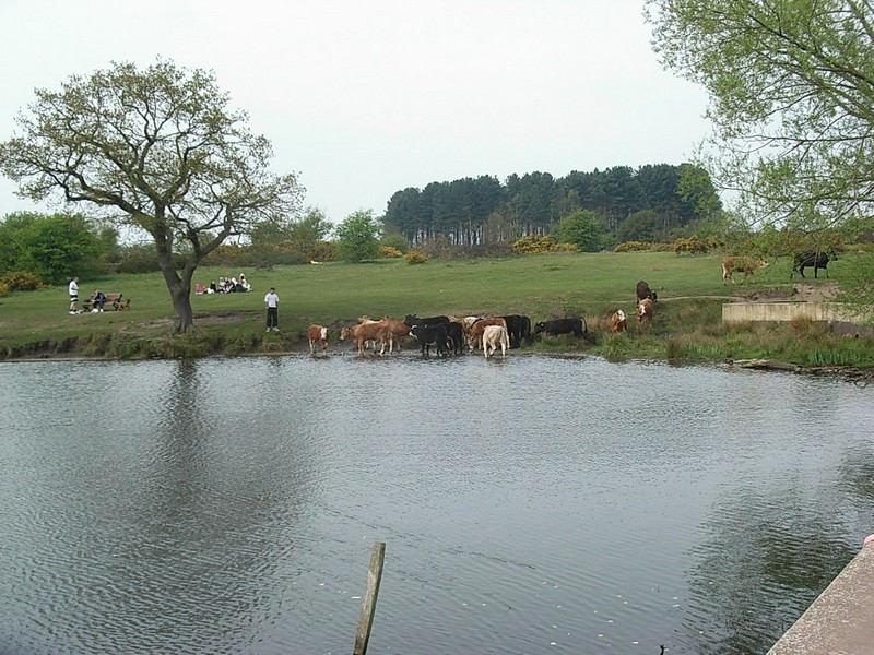
The Earls of Warwick were never in residence at Sutton; in 1419 Sutton manor house was let to Sir Ralph Bracebridge. He dammed Ebrook (Plantsbrook) to form Bracebridge Pool to provide fish,
notably bream, for food. At the east end of the dam is The Boathouse, now a restaurant, Rebuilt in a romantic gothick style in the 19th century, this may have originally been the hunting lodge on
the Coldfield referred to by John Leland who visited Sutton in 1538:
There be foure lodges in Southton Chace, Colfeld, Bere wood, Linderige, Hille-wood.
The lodge is reputed to have been stayed in by Henry VII.
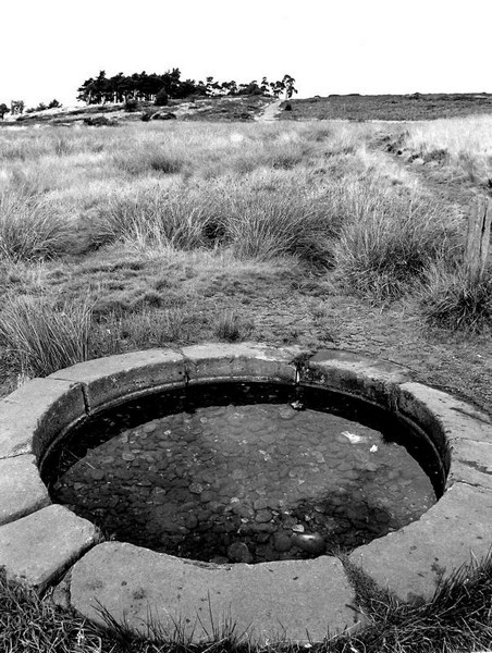
Keepers Pool was also made for the provision of fish. It was constructed by John Holte, the Keeper of Sutton Chase in the reign of King Henry VI. At each pool a dam holds back
the waters of the park's small streams and close to each is a quarry from which the stone was dug for the dam. Wyndley Pool on Longmoor Brook is believed to be the oldest of the fish ponds in the
park and may have been created soon after the setting up of the deer park in the 1100s.

Under the influence of Bishop Vesey Henry VIII granted Sutton Coldfield a charter of incorporation. The king gave up his lordship of the manor and invested manorial administration in a corporation, the Warden and Society of the Royal Town of Sutton Coldfield.
At his own expense Bishop Vesey emparked over 1000 hectares of the Chase for the benefit of the poor. Vesey enclosed the coppices known as the Seven Hays (ie. enclosures) to protect the coppiced
trees from grazing deer. Evidence of the embanked ditches may be still seen at Pool Hollies, Darnel Hurst, Lower Nuthurst, Upper Nuthurst, Hollyhurst on the town side of the park and at Streetly
Wood.
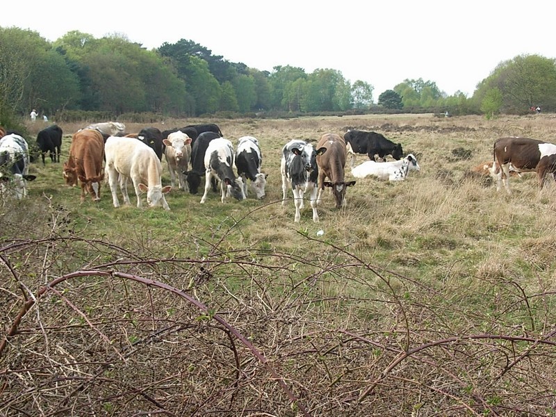
Vesey set up gates with locks, stocked the park with horses, enabled poor farmers to keep their cows within the park and gave a hay meadow whose profits went to support poor widows. Sutton residents were entitled to hunt fish and fowl in the park, with dogs, bows and arrows, and to hunt deer, hares, foxes and other wild beasts.
Sutton mills
By the middle of the 16th century a mill pool had been formed by the dammed waters of Plantsbrook. The stone dam acted as a road, now Sutton Parade, into the town. The water flowed under an arch and drove the corn mill on the east side of the dam. In 1668 after a breach in the dam caused serious damage to buildings in the lower town, the pool was drained and the mill demolished. Powell's Pool and Longmore Pool on Longmore Brook, and Blackroot Pool on Plantsbrook all date from the 18th century, and were created to run watermills. Close by can be found the quarries from which stone was dug to construct the pools' dams.
There is a record as early as 1510 of two watermills in Sutton Park; in 1576 three mills were being rented with the manor house. By 1585 one is known to have been a fulling mill, the other two
were blade-mills; and by 1688 four watermills are documented. None still survive though there is physical evidence, little of it visible, remaining of all of them.
In the north of the park Bracebridge Mill, which dated from the 16th century, made use of the 15th-century fishpond to operate blade-grinding machinery. Bracebridge Pool, fed by
Plantbrook, survives and the dam, which was enlarged at the end of the 19th, century, can clearly be seen. The millrace left the pool near Bracebridge Cottage, now a cafe, and the mill building
stood a little lower down.

Park House, near Town Gate, is the successor to an 18th-century millhouse; it is built in whitewashed brick with alterations and additions of 1898 in a timbered Tudor style and has a 20th-century extension. The 12-panel studded front door is late 17th-century and was brought from Worcester Cathedral during its restoration. A mill stood here from at least the 17th century probably grinding blades; it was rebuilt in 1770 to polish guns for the Napoleonic Wars.
The mill closed in 1840 and was partly demolished, though cottages next to Park House are the remains of the mill building. Park House was bought by Sutton Coldfield Corporation in 1948 with 10 hectares of land. Now a pub and restaurant, it is Grade II Listed. Small millponds fed by Plantsbrook survive to the rear and the mill leat still runs through the cellar.
Wyndley Mill, powered by Longmore Brook, was built as a blade mill before 1668 using the 15th-century fishpond as a millpool. Two mills are mentioned here in 1778. Belonging to the manor house the mill was later used for rolling steel and was known as New Forge. The mill was used for sawing c1840 up until the 1920s. The buildings which stood at the south end of the dam were demolished in 1962. The leat from the pool to the mill survives, as does the pool dam which faces Stonehouse Road in the park.

Powells Mill, further upstream stood near Boldmere Gate at the north end of the dam which runs alongside Stonehouse Road. It was powered by water from Sutton Park's largest lake. This had been made in the 18th century but was not actually incorporated into the Park proper until 1937.
John Wyatt used the mill in 1733 to experiment with the world's first cotton-spinning machine. It was here that the first ever mechanically-spun reel of cotton was made. The mill was used for spade making by William Powell in 1750; ash trees still seen in this area were very likely planted and coppiced for the spade handles.
It is also believed that the world's first all-steel garden fork was made here. The mill was used to roll steel for pen-making by 1882. Some steam power was used in the 19th century.
The dilapidated mill was demolished 1936 and no visible traces of the buildings remain. However, when the area was landscaped a waterfall was created where the millrace previously flowed through the dam.

Longmore Mill, east of Banners Gate, was built c1750 as a corn mill and operated until c1900; it had been used for corn grinding, button polishing and in leather production. The derelict mill buildings were demolished in 1938. The pool survives and the dam can be seen facing the roadway. Near to the Hartopp Entrance of the park stood Blackroot Mill fed by Plantsbrook and built in the mid-18th century; the mill was used in the leather industry.
During the 18th century there were concerted moves to make better use of 'wastes'. Arthur Young travelled extensively and wrote prodigiously on agriculture. He was particularly interested in
enclosure and in improving the land and became Secretary of the Board of Agriculture in 1793. In 1791 he travelled through Birmingham and on to Sutton Coldfield:
The 4th [August]. In the evening reached Sutton Cofield. I was struck with surprise to find so much waste land in the vicinity of the vast manufactures I had quitted.
The 5th [August]. Rode to examine some works carrying on under the direction of Mr. Elkington, a singularly able drainer.
In this excursion, which was entirely over great regions of land, absolutely waste. Here are at least 10,000 acres contiguous, which yield no other produce but that of feeding some wretched commoning cattle; for I was assured that we might ride to the extent of nearly 30 miles without quitting these contiguous wastes. All that I saw of them are highly and cheaply improveable.
What a disgrace to the political institutions of a kingdom whose government, trembling lest the people should want bread to eat, are constantly encouraging the import of foreign corn and cattle, butter and cheese, and hides and wool, yet permit such wastes as these to remain, even at the gates of such a market as Birmingham!
Arthur Young 1800 Tours in England & Wales Edited
Enclosure
In 1778 Sir Joseph Scott of Great Barr, a member of the Society of Sutton Coldfield, with 87 of the manor's landlords proposed sharing all the 'waste', including the park itself, among the principal landowners. The townspeople vehemently opposed the plan and the Corporation rejected the scheme. However, during the 1820s most of the common land, excluding the park, was enclosed. The resulting regular rectangular fields and long straight roads from Great Barr to the east of Sutton can be clearly seen on the 19th-century Ordnance Survey maps and most are still in evidence today.
In 1756 Simon Luttrell obtained an Act of Parliament by which he was permitted to extend his own park at Four Oaks Hall by annexing the 20 hectares of Sutton Park adjoining his land. See Four Oaks Park. And in 1827, Sir Edmund Hartopp, a later owner of the hall exchanged land with the Warden and Society. He gave up some 40ha of his own land, Meadow
Platt, in exchange for c25ha acres of the park adjoining his estate. As part of the deal Hartopp was compelled to cut Park Road and create Town Gate as a new entrance to the park. Prior to this
Wyndley Lane was the only access road to the park leading from the manor house on Manor Hill. In an exchange in 1937 the trustees of the Somerville Estate gave land which brought Powells Pool
into the park.

Recreation
The use of Sutton Park for recreation began towards the end of the 19th century encouraged by the opening in 1862 of the Sutton Branch Line from New Street Station. During the summer months daily excursion trains were laid on for day trippers for whom there were steam boat rides on Powells Pool and Blackroot Pool, donkey rides, open-air swimming in the lido at Keepers Pool and refreshment facilities.
In 1868 the enterprising Job Cole laid out the Royal Promenade Gardens near Wyndley Gate with refreshment rooms and later with overnight accommodation. In 1878 he built the Sutton Crystal Palace on a 15ha site (now the site of the artificial-surface football pitches near Wyndley Leisure Centre). The building was in a French chateau style with a prominent glass dome at the rear similar to London's Crystal Palace, and was used for entertainment and sport. It was demolished after 1962.
There were two horse-race courses in the park, and in 1880 a 9-hole golf course was laid out on Meadow Platt at the instigation of Rev W K Riland, Rector of Sutton. The present 18-hole course on the Streetly side of the park opened nine years later.

Wolverhampton & Walsall Railway
The cutting of the railway through Sutton Park in 1879 was the result of the purchase of the Wolverhampton & Walsall Railway by the Midland Railway Company to create a link with their Birmingham-Derby line. Leaving the Derby line between Water Orton and Castle Bromwich, the railway passes north of Sutton town centre, under Sutton High Street and Anchorage Road before entering the park.
The construction of the line provoked great controversy at the time and was hotly opposed. However, the railway company promised cheap coal for the local area and the Warden and Society of Sutton took £6500 for a 2-mile stretch of the park, some of it thankfully in cuttings.
There were stations at Penns, Sutton Town and Sutton Park and at Streetly. Sutton Town station, which closed in 1924, still stands in Midland Drive and is now used as offices. Sutton Park station
was built with three platforms, the extra one to allow for park excursion trains terminating here. The station building still stands on Station Approach and is now Sutton's mail-sorting centre.
Streetly Station stood just outside the north-west corner of the park on Thornhill Road. A recent housing development at Horsley Road is the site of the station. The line goes on to Aldridge
junction for either Brownhills or Walsall.
Being more circuitous than the Sutton Branch Line from Sutton Station to Birmingham New Street, the line never prospered. It closed to passenger traffic in 1965, but is still heavily used for
freight traffic as it enables goods trains to bypass the congested New Street Station.

A military training ground
The park has been used for military purposes since the 19th century when there was an army volunteer camp near Streetly. Evidence of the firing range near Westwood Coppice can be seen, and east of the Royal Oak Gate near Longmore Brook there remains a concrete trench dating to 1881 at the butts used for rifle practice.
During the First World War the Birmingham City Battalion of the Royal Warwickshire Regiment trained here and during the Second World War the park was used by regular troops and by the Home Guard. Parts of the park were used for testing tanks. A tablet erected after 1920 not far from Town Gate commemorates this military use:
This tablet is erected to commemorate the occupation of this park from 1914 to 1920 by His Majesty's troops. The park was placed at the disposal of H.M. government entirely free. Over 50,000 of H.M. troops occupied the various camps constructed. The Birmingham city battalions of the Royal Warwickshire Regiment received their training here and were followed by other units. For a considerable period the camps were used for convalescent officers and men -- and New Zealand troops also were in occupation prior to their return home. The council of the royal town received the thanks of the War Office for their patriotic action.

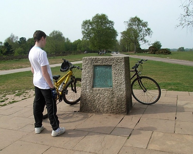
The World Jubilee Jamboree of the Scout Movement was held here in 1957 with 35 000 scouts from 37 different countries camped here. A memorial stone in the centre of the park commemorates the occasion.
Stone Age evidence
Evidence has also been found in the park of ancient times. During the Second World War people cutting peat for fuel found Stone Age flint arrow-heads at the base of the peat near Rowtons Well.
The discovery included a flint core; this is the waste flint that is left after arrows and scrapers have been chipped off a larger piece. And near Little Bracebridge Pool two flint scrapers, part
of a blade, flint flake and flint chips were found in 1959 beside a path leading north from the pool. The flake and chips are clear evidence that the tools had been made on this site. Flint is
not found in our area and therefore must have been imported, traded perhaps, from elsewhere.
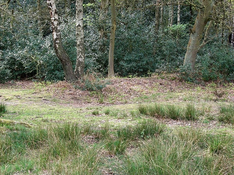
At the Streetly end of the park are six Bronze Age burnt mounds which were found in 1926. Only one mound is visible to the lay-person c400m from Crown Lane gate and topped by a stunted oak tree.
Intriguingly there is also evidence here of a possible hut circle of unknown date which has not been excavated. However, near Longmore Pool axe-marked tree trunks found in an 18th-century peat
pit strongly suggest a timber trackway. The preserved timbers were found in the enlarged channel of a tributary of Longmoor Brook. The fact that this was almost certainly a trackway clearly
implies that a village stood further up the hill nearby. However, no evidence of the settlement is known. The timber track may have survived because of local wet conditions, while a timber and
thatch village may have left little trace. Or the evidence may still lie below ground awaiting discovery.
Near Blackroot Pool are earthworks usually described as an 'ancient encampment' whose age, origin and function are not known. Located on the other side of the railway from Blackroot Pool, this is
a fascinating enigma. It is a large oval enclosure measuring 34m by 28m but unfortunately too badly damaged for positive identification. It may date from the Iron Age and is possibly evidence of
a settlement two and a half thousand years old.
Icknield Street
The most significant archaeological feature is the Roman road laid out in the 1st AD, whose well-preserved route is clearly visible along much of a stretch from the northern end of Westwood Coppice to Streetly Gate.
This road left the Fosse Way at Bourton-on-the-Water, passing via Alcester and on towards Metchley fort. It is known elsewhere as Ryknield Street though in Birmingham it is usually known by its medieval name, Icknield Street - its Roman name is unknown).
It enters Birmingham at Walkers Heath then follows Lifford Lane across the River Rea and through Stirchley; then from Breedon Cross along the Pershore Road to the junction with Bournville Lane. Its subsequent course is unknown: perhaps through Selly Park Recreation Ground near Metchley fort.
Another road, also known from medieval times as Icknield Street, then continued northwards, linking Metchley with the Roman fort at Wall near Lichfield and the north-east of England. Its route through the north of the city is unknown but it leaves the area of Metchley fort heading towards Perry Barr, possibly along Stoneleigh Road and Wellhead Lane. It almost certainly crossed the River Tame near the Old Ford west of Perry Bridge on Aldridge Road. It follows Kingstanding Road through Old Oscott and Kingstanding, along Westwood Road and into Sutton Park.
The park's medieval use a deer park meant that this section was no longer used and Sutton's subsequent and continuing use as a park has ensured the road's preservation. It is a Scheduled Ancient Monument.
The road leaves Sutton Park at Roman Road, Streetly whose Anglo-Saxon name has the same meaning as Stirchley, strete-leage, '(Roman) road clearing'. The route leaves Birmingham going north into
countryside at Forge Lane, Little Aston.
Near Rowton Hill close to the Roman road evidence of a possible Roman marching camp has been unearthed. This would have been a temporary feature used for a few days only by an army en route, possibly by the builders of the road themselves. It may be that the site was chosen because of the natural spring now known as Rowtons Well.
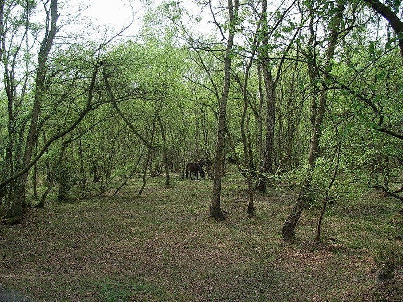
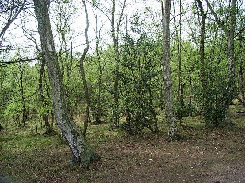
The underlying strata of Sutton Park consist of pebble beds overlain by boulder clays, glacial sands and gravels and alluvium along the valleys of the streams providing a range of habitats
including ancient and created woodland, wetland and heathland. In the context of the West Midlands conurbation it is of outstanding importance for its extensive and diverse habitats and the
richness of its flora and fauna.
The park which now covers some 1000 hectares was designated a Site of Special Scientific Interest in 1954, and a National Nature Reserve in 1997. It is the only such that is completely surrounded by urban development. The park is Grade II Listed in the English Heritage Register of Parks and Gardens of Historic Interest.


William Dargue 07.03.09
For 19th-century Ordnance Survey maps of Birmingham go to British History Online.
See http://www.british-history.ac.uk/mapsheet.aspx?sheetid=8806&compid=55141
and http://www.british-history.ac.uk/mapsheet.aspx?sheetid=8807&compid=55141
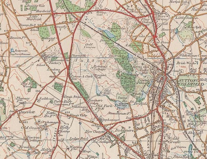
Map below reproduced from Andrew Rowbottom’s website of Old Ordnance Survey maps Popular Edition, Birmingham 1921. Click the map to link to that website.