A History of BIRMINGHAM Places & Placenames . . . from A to Y

William Dargue - A History of Birmingham Places & Placenames . . .  from A to Y


Four Ways

B28 - Grid reference SP108812

The Bulls Head at Four Ways © Copyright Darius Khan and licensed for reuse under Creative Commons Licence: Attribution-Share Alike 2.0 Generic. Geograph OS reference SP1081. See Acknowledgements for a direct link to the Geograph website.The Bulls Head at Four Ways © Copyright Darius Khan and licensed for reuse under Creative Commons Licence: Attribution-Share Alike 2.0 Generic. Geograph OS reference SP1081. See Acknowledgements for a direct link to the Geograph website.


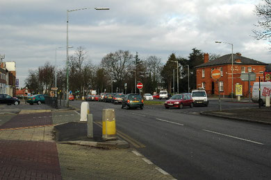
Four Ways junction is the crossroads of the Stratford Road with Fox Hollies Road and Highfield Road. The medieval Bulls Head here was rebuilt as a coaching inn in the mid-18th century. This was not a stage where horses were changed, but a request stop only.


See also Hall Green.


Google Maps - If you lose the original focus of the Google map, press function key F5 on your keyboard to refresh the screen. The map will then recentre on its original location.

For 19th-century Ordnance Survey maps of Birmingham go to British History Online - Maps.