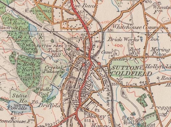
Tudor Hill
B73 - Grid reference SP116965

North-west of the High Street at Sutton Coldfield town centre, the hill is shown on the Ordnance Survey map of 1889. A street of the same name forms the basis of a housing estate overlooking Sutton Park. The name could be a 19th-century concoction emphasising the link between Sutton Coldfield and King Henry VIII.
Image from the National Archives on Flickr reusable under the Open Government licence.
William Dargue 25.07.2012/ 04.08.2012
For 19th-century Ordnance Survey maps of Birmingham go to British History Online.
Map below reproduced from Andrew Rowbottom’s website of Old Ordnance Survey maps Popular Edition, Birmingham 1921. Click the map to link to that website.