

William Dargue A History of BIRMINGHAM Places & Placenames from A to Y
Holly Bank Village
B13 - Grid reference SP077808
Hollybank Farm stood on Wheelers Lane opposite the junction with Barn Lane.
Standing right on the boundary of Yardley manor, it may have been of late medieval foundation having been set up on the fringe of the manor when all other land had been taken.
Its name may suggest an artificial bank, presumably with a ditch, and topped with a holly hedge, a prickly evergreen shrub which was used to prevent farm livestock from escaping.
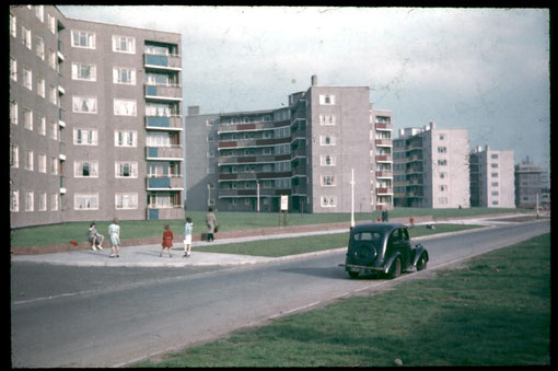
The farm buildings were demolished after 1945 when Hollybank Road was cut. Six blocks of flats, of a design first used in Tile Cross, were subsequently built along the east side of the road, with conventional housing opposite.
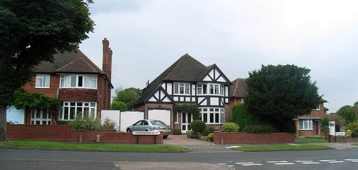
Holly Bank Village dates from the mid-1920s and was the result of a number of government housing acts after the First World War, by which the City Council was able to offer subsidies for the building of housing estates by private developers. Birmingham Mutual Housings Ltd bought a block of land, previously the fields of Haunch Farm, to the west of Billesley Common/ Hollybank Road and set to work from 1924 building some 500 semi-detached houses with garages.
The estate was said to have been designed with all the amenities of an urban village: a parade of shops, a doctor's and a dentist's surgery and a park. As with many names given by developers to their estates, this one has fallen out of use and the district is considered part of Kings Heath.
On Hollybank Road, Hollybank Spinney is a wood of about one hectare with mature ash, beech and oak trees by Haunch Brook along the banks of which grow alder and weeping willow.
Although the wood has no official designation, it should probably be classified as ancient semi-natural woodland dating from at least 1600.
William Dargue 15.03.2009/ 03.08.2010