William Dargue A History of BIRMINGHAM Places & Placenames from A to Y
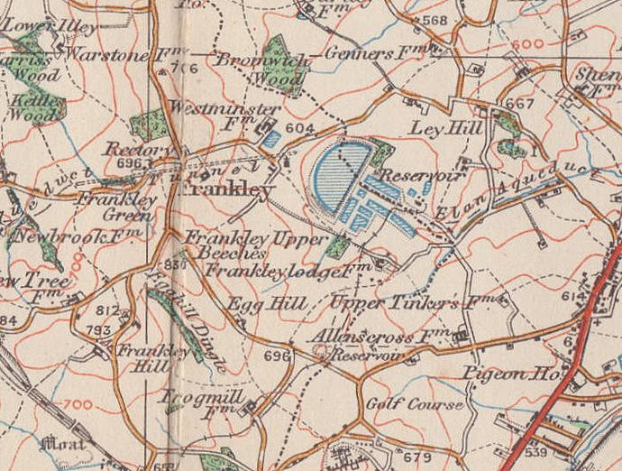
Egg Hill/ Egghill
B31/ B45 - Grid reference SO995794
Egg Hill at Frankley is not the only place so named in the country. The origin of the name is unknown, but it may well derive from an Anglo-Saxon personal name, Ecga, meaning 'Sword'. It may, on the other hand, may describe a topographical feature. The Anglo-Saxons had a number of words to describe different shapes of hill.
Here Egg Hill Lane rises up Egg Hill and past Egg Hill Farm towards Frankley Beeches. At the eastern end of the lane is the Egg Hill housing estate, a mainly municipal development which was built
after World War War 2. There were seven 9-storey tower blocks along Lower Beeches Road. The housing here has not stood the test of time and the whole estate began the process of
redevelopment in the early 2000s with many houses being demolished and rebuilt with improved shopping and community facilities. However, it was to be another ten years before serious rebuilding
began.
The north-west end of Egg Hill Lane is still entirely rural. Wheat and oats, potatoes and other root crops have long been grown on this clay soil, and there is also pastureland. An old fieldname
at Egg Hill, Hop Leasowe, indicates that this crop was grown here in the past.
William Dargue 21.11.2008/ 02.08.2010
For 19th-century Ordnance Survey maps of Birmingham go to British History Online.
Map below reproduced from Andrew Rowbottom’s website of Old Ordnance Survey maps Popular Edition, Birmingham 1921. Click the map to link to that website.