William Dargue A History of BIRMINGHAM Places & Placenames from A to Y
Ridgacre/ Ridgeacre
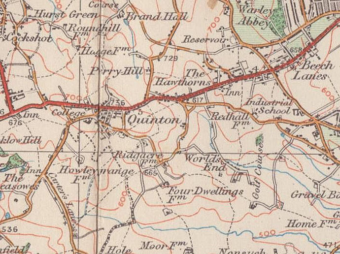
B32 - Grid reference SP006847
The Domesday Book records a grange of the Convent of Hales (Halesowen) at Ridgacre. Its probable successor, Ridgacre Farm stood at the junction of Ridgacre and Quinton Road and survived into the 20th century when the farmland was built over with housing.
Known as Ridgacre at Domesday the name derives from the Anglo-Saxon, hrycg aecer meaning 'ridge acre' or perhaps just 'field on a ridge'. The manor later became known as Quinton.
Although the name Ridgacre still had currency at the beginning of the 20th century, it is no longer in use. The The name Quinton replaced Ridgacre and the district amalgamated with Birmingham in
1909.
See Quinton.
William Dargue 31.07.2010
For 19th-century Ordnance Survey maps of Birmingham go to British History Online.
Map below reproduced from Andrew Rowbottom’s website of Old Ordnance Survey maps Popular Edition, Birmingham
1921. Click the map to link to that website.