William Dargue A History of BIRMINGHAM Places & Placenames from A to Y
Ravenhurst, Harborne
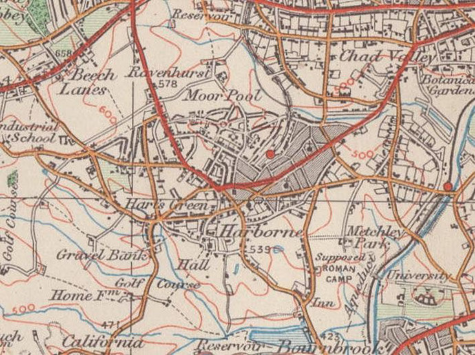
B17 - Grid reference SP030853
Ravenhurst in Harborne was located at the the junction of Gillhurst Road and Ravenhurst Road. Lower Ravenhurst Farm was immediately east of the junction; Upper Ravenhurst Farm was a little further north almost at what is now Knightlow Road.
The fields which lie between Gillhurst Road and Knightlow Road were bought as playing fields for St Philip's RC Grammar School which was set up by the Birmingham Oratory in 1887. Cardinal Newman often used to take a walk here from the Oratory in Edgbaston, some two miles, after lunch to watch the boys playing football or cricket.
For the origin of the name, see Ravenhurst, Highgate.
William Dargue 24.07.2012
For 19th-century Ordnance Survey maps of Birmingham go to British History Online.
Map below reproduced from Andrew Rowbottom’s website of Old Ordnance Survey maps Popular Edition, Birmingham 1921. Click the map to link to that website.