William Dargue A History of BIRMINGHAM Places & Placenames from A to Y
Lindridge, The Lindridge
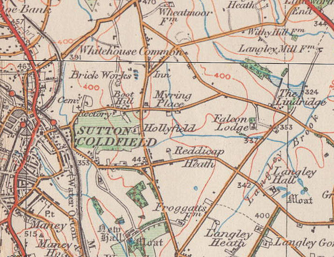
B75 - Grid reference SP147968
Lynderyche: first record 1481

There are some half a dozen Lindridges across the country. It is likely that the meaning derives from the Old English lind hyrcg ie. 'lime-tree ridge. Lindridge lies in a rural setting east of Sutton Coldfield just beyond the municipal estate of Falcon Lodge.
John Leland's wrote during the 1530s that there 'be foure lodges in Southton Chace, Colfeld, Bere wood, Linderige, Hille-wood.' Lindridge was part of Sutton Chase, the hunting grounds of
the Earls of Warwick. Lived in by the keepers of that part of the chase, the lodges were available for the use of royal or noble guests when they came to hunt for deer. The location of the lodge
is not known. See Sutton Chase.
The 19th-century Ordnance Survey maps show The Lindridge on Lindridge Road south of Lindridge Pool. Presumably it is the name of a house.
William Dargue 01.08.2010
For 19th-century Ordnance Survey maps of Birmingham go to British History Online.
Map below reproduced from Andrew Rowbottom’s website of Old Ordnance Survey maps Popular Edition, Birmingham 1921. Click the map to link to that website.