William Dargue A History of BIRMINGHAM Places & Placenames from A to Y
Lea Hall/ Ley Hall, Lea Hill, Handsworth
B20 - Grid reference SP061909
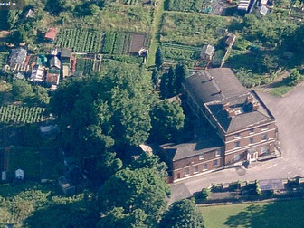
Lea Hall at Handsworth Wood stands at the junction of Wood Lane and Lea Hill Road. Named after Lea Hall Farm, which stood on Wood Lane, Lea Hall is a three-storey neo-classical brick house built for the wealthy Muntz family c1800, which replaced an earlier building.
The earliest reference to the name appears to be in 1635. Lea Hall, a Grade II Listed building, is now the headquarters of the Lea Hall Allotments Society. the name itself is medieval and refers to a clearing, probably agricultural, in a wooded landscape.
The name is also used for the nearby railway junction on the Birmingham-Liverpool Grand Junction Railway. The line was constructed in 1837, but the junction itself came into being fifty years
later when the Perry Barr-Soho Loop was laid down to join the Grand Junction with the Birmingham, Wolverhampton & Stour Valley Railway.
See also Lea Hall in Kitts Green.
William Dargue 02.04.2009/ 21.11.2010
For 19th-century Ordnance Survey maps of Birmingham go to British History Online.
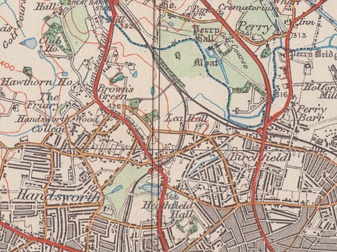
Map below reproduced from Andrew Rowbottom’s website of Old Ordnance Survey maps Popular Edition, Birmingham 1921. Click the map to link to that website.