William Dargue A History of BIRMINGHAM Places & Placenames from A to Y
Hodge Hill
B36 - Grid reference SP132890
Hidgehyll: first record 1569
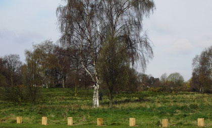
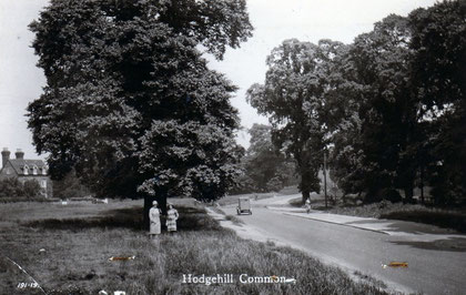
Take a look - Hodge Hill Common.
This is a precious piece of undeveloped land around the junction of the Coleshill Road and Bromford Road. Hodge is probably the family name of a medieval landowner, but this was also a by-name of Roger, used as a patronising nickname for an agricultural labourer, ie. 'a country bumpkin'.
The name Hodge Hill may have applied as much to the route across the common as to the hill itself and it could equally have referred to the Coleshill Road or to Bromford Road, both locally
important through-routes from medieval times.
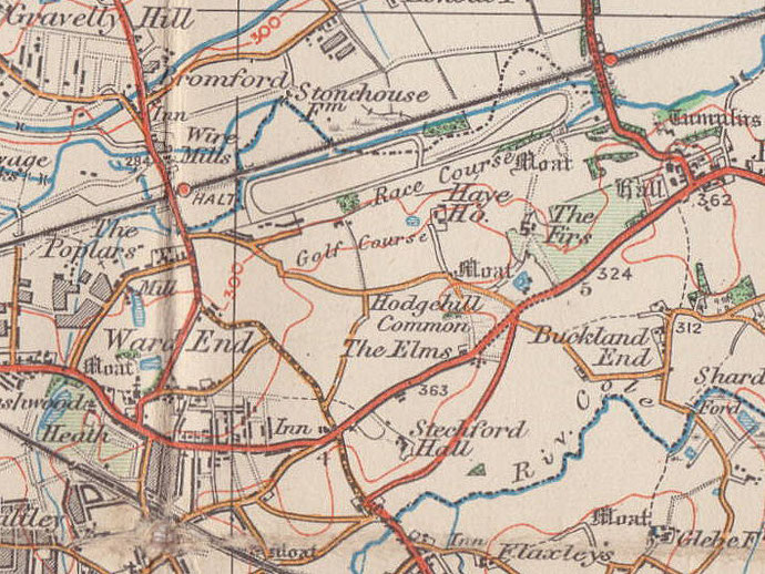
The 1834 Ordnance Survey map shows the location as being at the junction of the two roads.
Hodge Hill lay towards the west end of Castle Bromwich, a manor which stretched from Bromford Lane between the Rivers Tame and Cole to Water Orton until 1931 when the western half of the manor amalgamated with Birmingham. The name came gradually into use after the Second World War with extensive private housing development which had first started in the previous decade. The modern district lies east of Bromford Lane with the exception of the Bromford Estate, north of the River Cole and west of the junction of Newport Road and Heathland Avenue, a location locally known as The Clock after the garage there.
Hodge Hill Common lies on sand pushed here from Wales and the North of England over ten thousand years ago by the glaciers of the Ice Age. A commercial sandpit is documented here as it
changed ownership from the Lunt family to Thomas Wiseman in 1812. The pit was certainly older. No trace is visible on the ground but the site is known from an aerial photograph taken in 1980.
There is evidence here of prehistoric occupation, though its interpretation is open to question. Christopher Chattock was a 19th-century antiquary whose family had lived locally since the 14th
century. In 1884 he described standing stones and earthworks which he believed to date back to the Bronze Age. Chattock also reported having seen burial mounds on Hodge Hill Common, one of which
was partially demolished by the Birmingham-Castle Bromwich turnpike in 1760. The largest mound measured 40m x 12m and was 2 metres in height. These mounds seem no longer to be visible.
Chattock thought that two nearby stones originated from the burial mounds. A standing stone used as a hoarstone, a medieval estate boundary marker, also stood by the Fazeley Canal near the Navigation Inn at Bromford. When the canal was cut the stone was partially buried and by 1884 it had beeen covered up altogether. Stone is not found naturally in this area, the nearest available being along the Birmingham sandstone ridge, at Gravelly Hill, for example. Another stone 1.5m high stood until the late 19th century where Bromford Road leaves Hodge Hill Common. This too was used as a hoarstone on the Chattock estate.
The Chattock family lived at Hay Hall near the junction of Reynoldstown Road and Doncaster Drive. This was probably the manor house of Hodge Hill. Mentioned as a separate manor
in 1622, it appears to have been administered with Castle Bromwich, although its existence as a specific entity is recorded only as late as 1810. The hall had a double moat which makes a
13th-century date probable. Richard II (r.1377-1399) permitted Henry Chattock to embattle the hall which in 1603 was rebuilt probably for the third time. The moat is shown on the 1834 Ordnance
Survey map but was drained c1850 and is now built over. This moated site was abandoned and Haye House was built to replace it near Ermington Crescent/ Haye House Grove. This may have been the
1603 rebuilding and is arguably, though disputably the Comet Inn in Collingbourne Avenue.
Another so-called moated site was that of Moat House Farm. This was a three-storey double fronted farmhouse probably of Georgian date which stood until c1963 on the Coleshill Road where Chipperfield Road is now. The site of the house is probably now that of the low-rise flats, Hodge hill Court. As Somerlands Farm it was occupied by the Somerlands family from the time of Richard II to the reign of Elizabeth I. Chattock maintained, however, that the clear depressions on the site were not evidence of a moat but the remains of tan pits. The Somerlands were succeeded at the house by one Richard White, a tanner of Birmingham. During the 19th century this was a mixed farm of some 300 acres/ c120 hectares. From the 1920s almost until its demolition there was a saw mill and wood yard here.
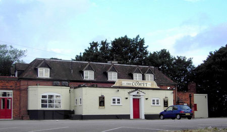
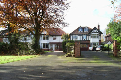
Take a look at the Comet.
Built by a member of the Chattock family, this early 17th-century timber-framed building, Haye House (1603?) was used as the club house for Castle Bromwich Golf Club from 1901 until 1947.
The course was then sold and built over with housing and the club moved to Maxstoke Castle where it is still situated. Subsequently the Comet became a public house, a balti restaurant and has now been demolished.
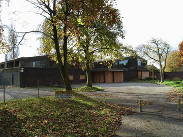
St Philip's & St James' Church
A dual-purpose church/ church hall was built at the top of Hodge Hill Common after World War 2. Plans were drawn up in the 1960s to build a church here and for the existing building to become the church hall. However, in 1966 the building was badly damaged by fire and was subsequently demolished.
In 1968 Birmingham University theologian J G Davies published a book entitled ‘The Secular Use of Church Buildings'. It was, in effect, the manifesto of a movement to build new churches as social centres for the local community, Christian or not, which Christians could also use for worship.
The new church of St Philip and St James under its architect, Martin Purdy, became the physical expression of that movement. It was designed as a multi-purpose space which could be subdivided by sliding screens to create smaller halls and rooms. In the middle of the building was the sanctuary which could not be screened and was permanently on view.
Davies stated that
the early Christians did not put their church buildings to secular use, simply because they had no church buildings as such, but the physical location of their particular acts of worship witnessed to their understanding of the unity of sacred and secular in and through Christ - they assembled in private houses.
The new St Philip's and St James' was opened by the Bishop Wilson in 1968. It was deemed in 2008 that the high cost of repairs to the building were uneconomic and the church was closed. The Anglican congregation moved to share the building of the ‘Blue Cross' United Reform Church on Coleshill Road.
See also Stechford Hall, Stechford.
William Dargue 20.11.2008
For 19th-century Ordnance Survey maps of Birmingham go to British History Online.
Map below reproduced from Andrew Rowbottom’s website of Old Ordnance Survey maps Popular Edition, Birmingham 1921. Click the map to link to that website.