

William Dargue A History of BIRMINGHAM Places & Placenames from A to Y
Heartlands
B8 - Grid reference SP098896
First record c1992
This name was coined when the Birmingham Heartlands Development Corporation was set up by the Government in 1992. Its aim was to revitalise a long swathe of c1000 hectares of decayed industrial land along the Rea and Tame valleys. Heartlands includes parts of Bordesley, Saltley, Nechells and Bromford. The Development Corporation had extensive powers of compulsory purchase and planning and worked as a facilitator between public and private enterprise. It was wound up in 1998 having largely achieved what it was set up to do.
The Heartlands Spine Road opened in the late 1990s and was later renamed Heartlands Way from Saltley to Bromford Bridge. From Bromford Bridge to the Chester Road it is called the Fort Parkway named
after the Fort Dunlop tyre factory. Along the spine road are industrial and warehousing units, wholesale and retail centres and leisure facilities. The largest of these is the c10 hectare site of
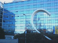
Star City, a leisure complex with a multi-screen cinema, casino, bowling alleys, bars and restaurants which cost some £100 million to build. In 2007 work was completed on the imaginative
redevelopment of the main block of Fort Dunlop for residential and recreational use.

This name was coined when the Birmingham Heartlands Development Corporation was set up by the government in 1992. Its aim was to revitalise a long swathe of c1000 hectares of decayed industrial land along the Rea and Tame valleys. Heartlands includes parts of Bordesley, Saltley, Nechells and Bromford.
The Development Corporation had extensive powers of compulsory purchase and planning and worked as a facilitator between public and private enterprise. It was wound up in 1998 having largely achieved what it was set up to do.
The Heartlands Spine Road opened in the late 1990s and was later renamed Heartlands Way from Saltley to Bromford Bridge. From Bromford Bridge to the Chester Road it is called the Fort Parkway
named after the Fort Dunlop tyre factory.
Along the spine road are industrial and warehousing units, wholesale and retail centres and leisure facilities. The largest of these is the c10 hectare site of Star City, a leisure complex with a multi-screen cinema, casino, bowling alleys, bars and restaurants which cost some £100 million to build. In 2007 work was completed on the imaginative redevelopment of the main block of Fort Dunlop for residential and recreational use.
The HS2 railway line from London is being built along this corridor emerging from the Water Orton/ Castle Bromwich tunnel at Bromford on its way to Birmingham Curzon Street. A maintenance depot is being built at Bromford near the the tunnel portal. Completion is expected to be in 2030.
Click to enlarge the images below.


William Dargue 21.03.2009/ 30.11.2020
For 19th-century Ordnance Survey maps of Birmingham go to British History Online.
See http://www.british-history.ac.uk/mapsheet.aspx?sheetid=10095&compid=55193,
http://www.british-history.ac.uk/mapsheet.aspx?sheetid=10085&compid=55193
and http://www.british-history.ac.uk/mapsheet.aspx?sheetid=10086&compid=55193.